Northern India’s Flood Fury: A Climate Emergency Unfolding
The 2025 monsoons have hit northern India an an unprecedented manner, submerging vast areas under water. Punjab, Himachal Pradesh, Jammu and Kashmir, Uttarakhand, and parts of Haryana and Delhi are experiencing some of the heaviest rainfall in decades. These are sending us a clear message about how our climate is changing fundamentally.
Punjab Under Water
Punjab is reeling from what officials are calling the state’s worst floods in nearly four decades. All 23 districts have been declared disaster-affected areas, with over 1,200 villages completely waterlogged. More than 33 lakh people have been severely impacted, and thousands of families have had to abandon their homes. The agricultural losses are staggering, over 3.75 lakh acres of farmland lying submerged.
The state’s major rivers, particularly the Sutlej and Beas, are flowing well above danger levels due to rains combined with massive water releases from the Bhakra and Pong dams. Just on 3rd September, nearly 65,000 cusecs of water had to be released from the Bhakra dam. The impact varies dramatically across different regions of the state. The Majha and Doaba regions, covering districts like Gurdaspur, Amritsar, Hoshiarpur, and Kapurthala, have faced the brunt of this devastation. The southern Malwa belt has been relatively less affected but remains on high alert as river levels continue rising.
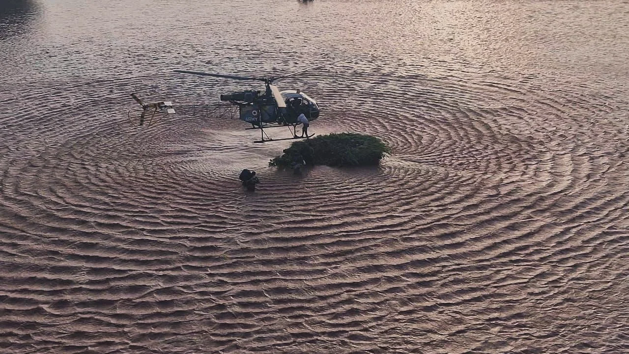
Himachal Pradesh: Landslides and Cut-off Communities
Himachal Pradesh has officially declared itself flood-affected, with over 300 reported deaths and losses exceeding ₹3,000 crores. The mountain state has witnessed widespread destruction after experiencing its wettest August in 76 years, with rainfall surplus touching nearly 70 percent above normal levels.
Districts such as Kullu, Mandi, and Chamba have been hit by flash floods and landslides that have swept away homes and severely damaged major highways. The crucial Chandigarh-Manali highway has suffered damage at multiple locations. High-altitude regions, including Lahaul-Spiti and Kinnaur, are now completely cut off from the rest of the state. Essential supplies, medical services, and communication networks have been disrupted, leaving many communities completely isolated from outside help. Landslides triggered by water-saturated soil are burying roads and houses, while flash floods are tearing through valleys, uprooting massive trees and bringing down bridges.
Even the national capital hasn’t been spared from this. The Yamuna River breached the danger mark on 4th September. Similar situations have been reported from Haryana and Jammu and Kashmir, where swollen rivers have submerged farmlands and entire villages.
Weather Pattern Analysis
The Indian Meteorological Department (IMD) has confirmed that Punjab received 253.7 mm of rainfall during August—that’s 74 percent higher than normal levels, breaking a 27-year-old record. Similarly, Himachal Pradesh experienced its wettest August since 1949.
One of the key factors behind these extreme weather conditions has been the unusual persistence of western disturbances. These weather systems, which normally bring winter rains to north India, have remained active well into the monsoon months. When these disturbances interact with moisture-laden monsoon winds from the Arabian Sea, they create prolonged periods of heavy rainfall across both plains and mountainous regions.
IMD forecasts are warning that more heavy rainfall is expected in the coming days. Red alerts have been issued for Punjab, Himachal Pradesh, Uttarakhand, Haryana, and Delhi. Their latest bulletin indicates that localised flooding, severe waterlogging, and fresh landslides are likely across multiple districts.
Climate Change and Extreme Rainfall Events
The scientific evidence is quite clear on this matter. Rising global temperatures are making rainfall events much more intense. Warmer air has the capacity to hold more moisture, and when this moisture gets released, it results in much heavier downpours. Climate models are suggesting that northern India will experience more frequent episodes of extreme rainfall in the coming decades, characterised by shorter but significantly more intense wet periods.
This year’s floods are a perfect example of this emerging trend. Apart from excess monsoon rainfall, several regions have also witnessed sudden cloudbursts, particularly in Uttarakhand and Jammu and Kashmir, which have triggered devastating flash floods. These unpredictable weather events are becoming increasingly common throughout the Himalayan region.
Environmental and Infrastructure Vulnerabilities
While excessive rainfall is the immediate trigger, human activities have significantly amplified the scale of this disaster. Widespread deforestation has severely reduced the land’s natural capacity to absorb rainwater and stabilise slopes. The expansion of highways, numerous hydropower projects, and unregulated construction activities along riverbanks have destabilised fragile ecosystems throughout the region. The Supreme Court has recently noted that illegal tree cutting has contributed to both floods and landslides, and has sought detailed explanations from both central and state authorities.
Urban areas are facing their own set of challenges. Poor drainage infrastructure, encroachment on natural floodplains, and outdated embankment systems have transformed heavy rainfall into catastrophic urban flooding scenarios. Delhi’s waterlogged roads and completely submerged underpasses perfectly illustrate the risks faced by rapidly expanding cities that lack resilient infrastructure.
The Path Ahead
The 2025 floods have underlined the critical urgency of completely rethinking our disaster preparedness strategies. Reservoir management systems need to be significantly strengthened so that dam releases are carefully planned and properly coordinated to minimise downstream flooding impacts. Enhanced cooperation between different states is necessary to ensure that extreme water discharges don’t worsen humanitarian crises.
Early warning systems must be expanded to provide hyperlocal and real-time alerts to communities. People can be much better protected if rainfall patterns and river levels are continuously monitored and warnings reach them well before disasters strike. Strategic investments in weather forecasting technology, communication networks, and community-level disaster preparedness training will make emergency responses much quicker and more effective.
Our infrastructure also desperately needs to be made climate-resilient. Roads, bridges, and drainage systems should be designed and built to withstand heavy rainfall events, while urban planning must prioritise natural drainage by preserving existing wetlands and restoring floodplains. In rural areas, comprehensive crop insurance schemes and diversified income sources can provide farming families with crucial financial buffers against the recurring risk of flood-induced losses.
Equally important is large-scale ecosystem restoration. Massive reforestation programmes, scientific watershed management, and riverbank protection initiatives will help the land absorb much more rainfall and significantly slow down floodwater flow. Forests and wetlands serve as natural barriers against disasters, and their protection and restoration are just as crucial as constructing embankments or drainage systems.
The devastating floods across northern India serve as a stark reminder that our monsoon patterns are undergoing fundamental changes. While immediate relief and rescue operations can address the current suffering and displacement, the much larger challenge lies in long-term planning and adaptation.